Length
25.5 mi
Total Elevation Gain
1,522 ft
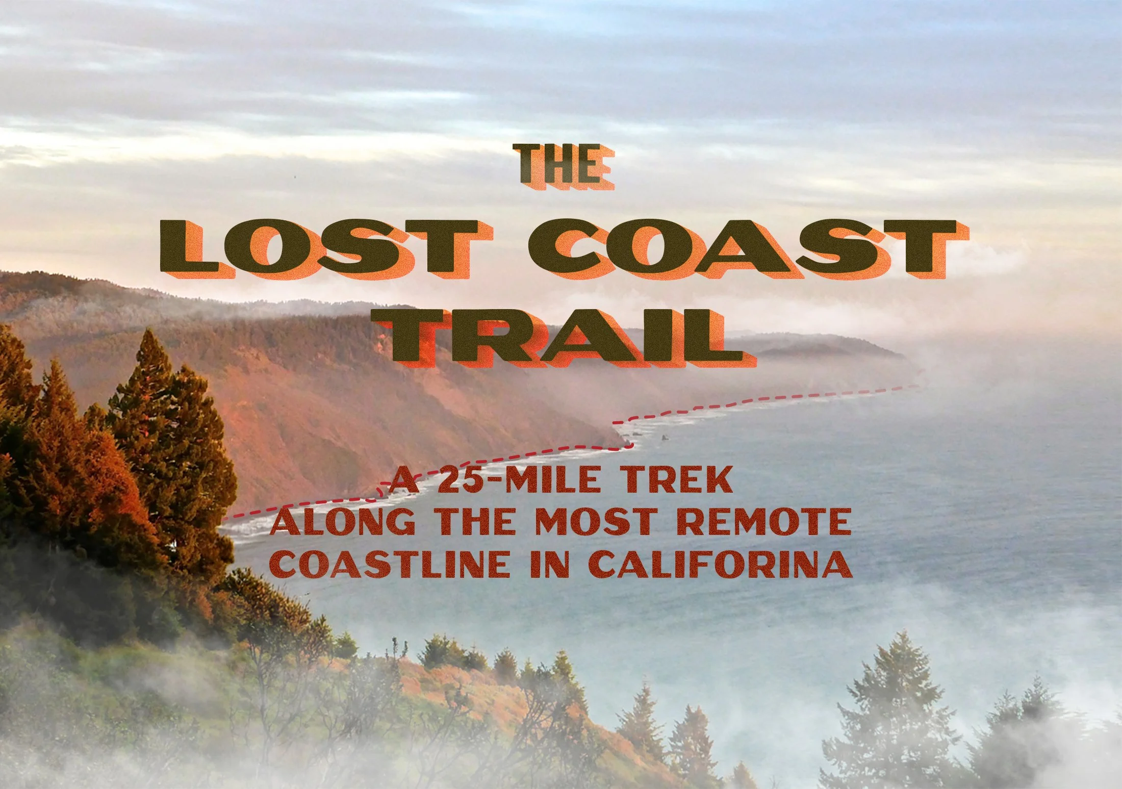
The Lost Coast Trail is a famous, rugged 25-mile point-to-point backpacking route where the King Range Mountains plunge directly into the Pacific Ocean. It is renowned for total isolation, wildlife, and mandatory navigation around impassable tide zones.
The technical challenge of this trek is not to be underestimated. The trail takes us along the rugged California coastline—alternating between rocky boulders, sandy beaches, and exposed bluffs. To our west will be the beautiful, powerful, and unforgiving Pacific Ocean. To our east, the steep, unscalable face of the King Range Mountains. We will navigate the thin boundary between them as we make our way south from Mattole Beach to Shelter Cove. Portions of the trail are impassible at high tide, requiring us to carefully time each day’s hike according to the tide tables.
Diagonally shaded areas indicate portions of the trail that are impassible at high tide. The green wave indicates tide height.
The reward for this often arduous, sometimes treacherous trek is the adventure of a lifetime. Hikers of the Lost Coast Trail report encountering colonies of sea lions and elephant seals, herds of elk, and black bears on the beach. Beached whales are not uncommon (though less likely this time of year).
Because of its remote and undeveloped location, at night the skies will be as dark as you’ve ever seen them. Our trip is planned to coincide with a new moon and the peak of the Perseids meteor shower—a combination of celestial events that only occurs once every 19 or so years.
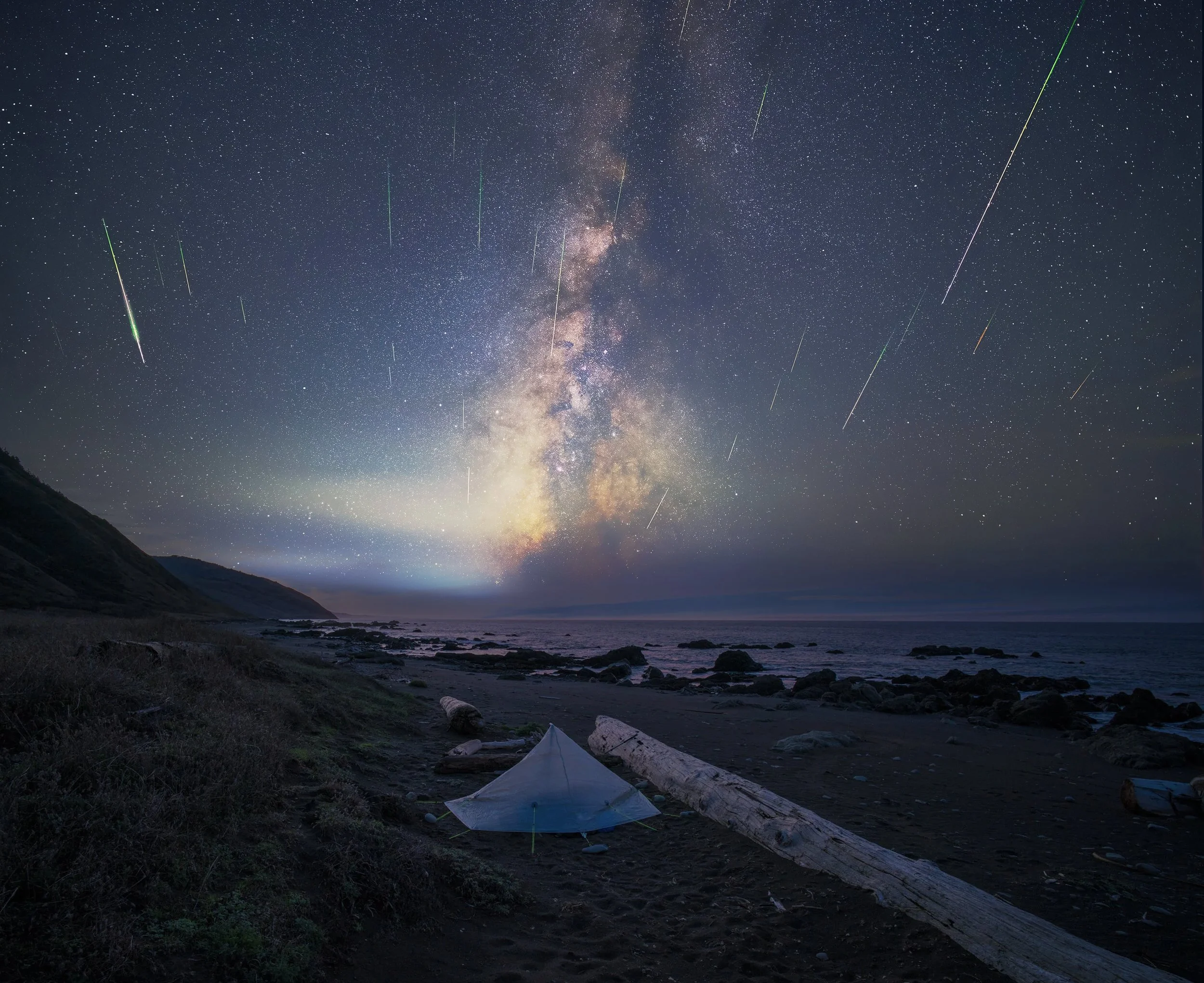
Weather permitting, this year’s Perseids meteor shower is expected to have exceptional visibility, thanks to a new moon.
There are no established campsites. We’ll make camp on the beach above the high tide point, or creekside along one of the many streams and rivers that empty into the Pacific. Fresh water should be abundant, but requires purification.
Between a rock and a hard place: The Lost Coast Trail is a narrow strip of land between the Pacific Ocean and the King Range Mountains.
Special Requirements: Scouts must be 14+ to participate, in strong physical condition, and mentally prepared to deal with the challenges of backcountry backpacking.
We will be carrying all our food, fuel, and gear, making the trip even more strenuous.
Pre-Trip
Meeting One
Trek review and hazards briefing
Meeting Two
Meal Planning
Meeting Three
Food packaging, Pack Check
Friday, July 10
Pack Impound
Trip Itinerary
Wednesday, August 12
11 am Depart SF
4 pm Arrive Shelter Cove
Thursday, August 13
10 am Shuttle to Matthole Beach
12 pm Arrive Matthole Beach
2:30 pm Commence Trek
7 pm Make Camp at Randall Creek
Friday, August 14
Randall Creek to Big Flat
Saturday, August 15
Big Flat to Shelter Cove
Early am start to beat the tide
Arrive at Shelter Cove around noon
Return to SF
Planning Tools
Master Planning Document
Specialty Equipment
Bear Canisters: Required by the Bureau of Land Management (BLM) to protect food from coastal wildlife.
Tide Chart & Waterproof Map: Absolutely essential. Several miles of the trail are impassable at high tide; our daily route must be planned around the tides.
Sturdy, Fast-Drying Footwear: Your feet will inevitably get wet due to the sandy terrain, tidal crossings, and creek mouths. Breathable trail runners or water shoes may be better than heavy, waterproof hiking boots. If you prefer hiking boots, use removable insoles.
Low-Profile Gaiters: To prevent fine beach sand from entering your shoes and causing severe blisters.
Freestanding Tent & Sand Stakes: High winds and thick coastal fog are common. A durable, double-wall freestanding tent is strongly recommended. Traditional stakes will not hold in loose sand.
Trekking Poles: Highly beneficial for balancing on uneven, slippery, and rocky shoreline sections.